Just south of Morris County’s Rockaway River is a collection of trails in Tourne County Park. One trail in particular leads directly to the “Top of the Tourne”; on its summit sits the glacial erratic known as the Mouse Cradle Balancing Rock. This 54-ton boulder balances above two points of ledge rock and a wedge stone, seemingly like magic.
The Tourne is a rather unassuming mountain, and a great Morris County hike for beginners. In fact, Tourne County Park offers plenty of sites worth exploring and many year-round activities for visitors. Despite Tourne’s many hiking trails, today we are focusing on how to get to the Mouse Cradle Balancing Rock
More from Best of NJ
Arrival and Parking
There are a couple different ways to get to Tourne County Park. First, McCaffrey Lane in Denville cuts right through the park. You can reach this road from either Norris Road (on the west) or Powerville Road/Elcock Avenue (east). No matter which side you come from, you can access the trails as well as Mouse Cradle Balancing Rock.
Likewise, there’s plenty of parking at Tourne County Park. As soon as you turn onto McCaffrey Lane, you’ll notice parking spaces on the side of the road; however, the park has several lots to choose from. The one closest to the Norris Road entrance usually has the most activity, but for good reason; Next to the spacious parking lot, there are picnic tables, a gazebo, porta potties, and a playground. Just east of the playground are the trails leading to Mouse Cradle Balancing Rock.
The Trail to Mouse Cradle Balancing Rock
The first trail you’ll link up with is the red trail. (If you cross the street after parking your car, you’re heading in the wrong direction.) The red trail quickly leads to the yellow trail, also known as the Decamp Trail. To get to Mouse Cradle Balancing Rock, you can either follow this trail to your left or continue straight. If you go straight, you’ll have to make a left onto the Decamp Trail at the very next fork. If you turn left at your first chance, however, you’ll be led to the Top of the Tourne quicker.
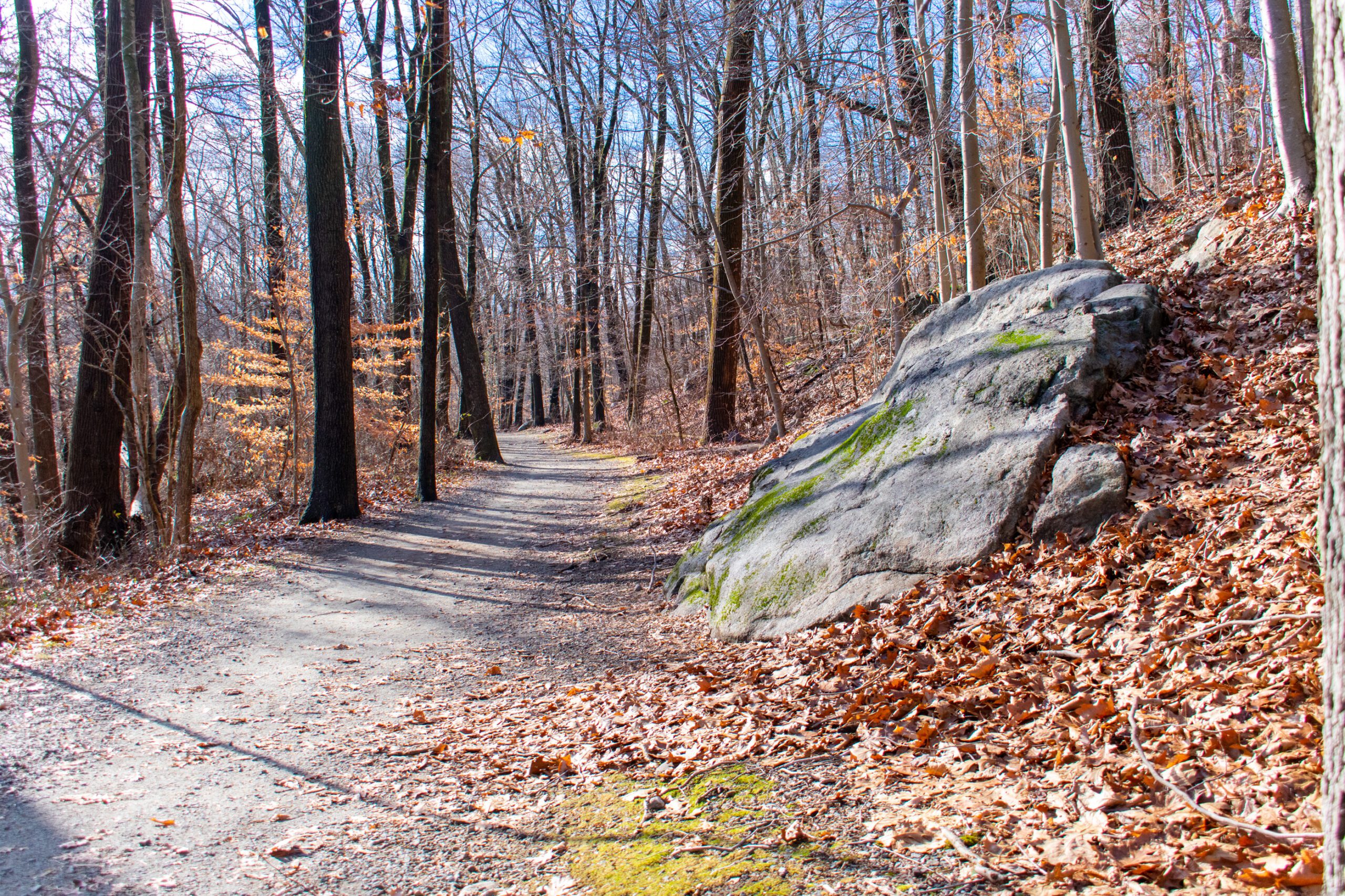
These trails are mostly flat, and you’ll mostly contend with gravel but no roots. But certain areas of Tourne County Park can get rocky, specifically the closer you get to the vistas. As you follow Decamp Trail to your left, you’ll head straight north. It’s important to know the trail is a bit winding, with a couple big loops. Before reaching Mouse Cradle Balancing Rock, you’ll come to the first of two scenic views on your right. This view mostly consists of trees, but offers a striking blend of colors during the fall and spring.
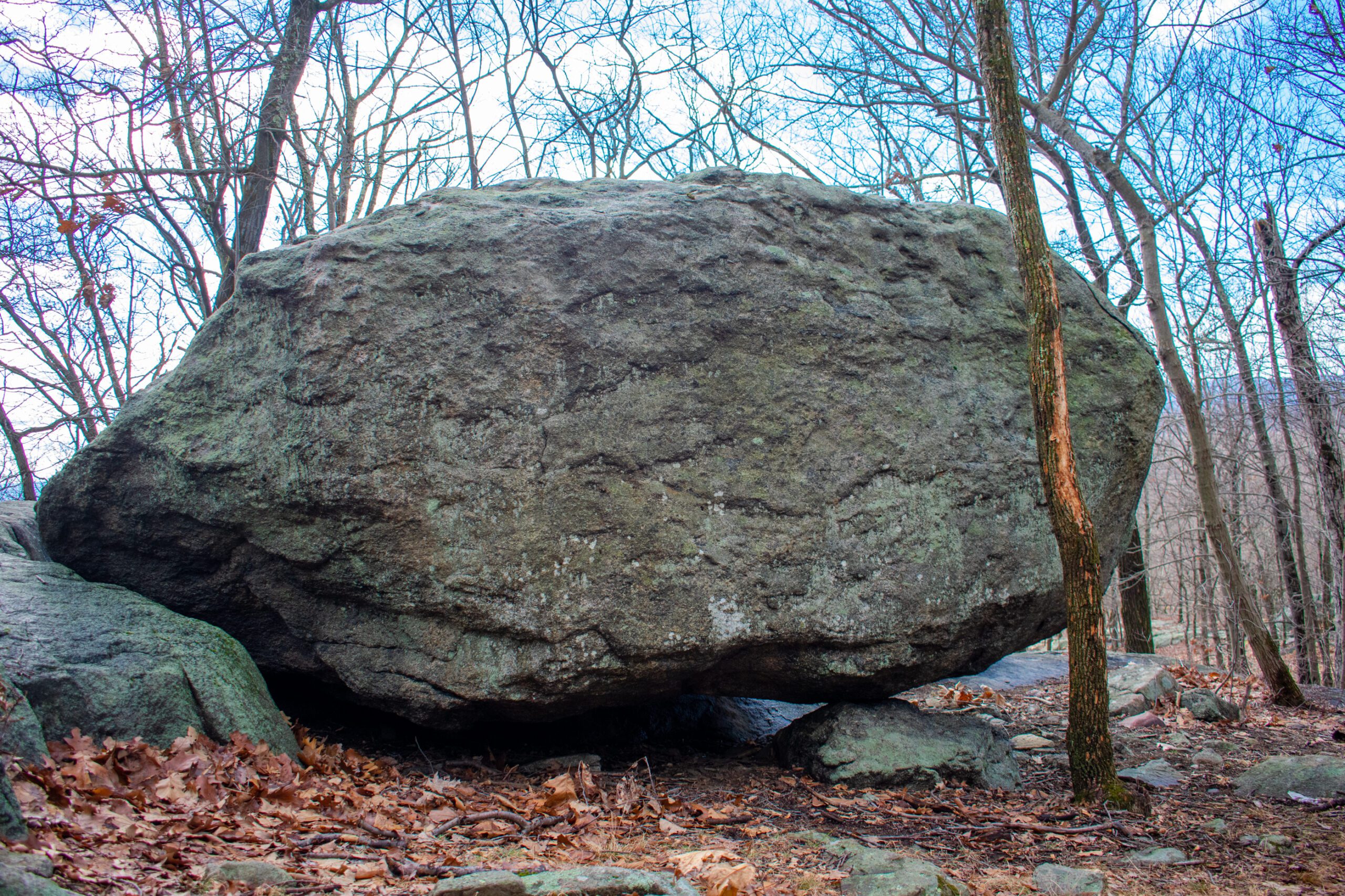
The trail takes a sharp turn right immediately after the first scenic view, and then starts to bear left. At this point, you’ll reach the trail leading down toward Mouse Cradle Balancing Rock. The path will get a bit steep, and there are some visible roots nearby, so watch your step. After a short walk, you’ll have a clear view of the rock formation. Despite sections around the rock being closed for safety, you’ll have a 360-degree view of Mouse Cradle Balancing Rock.
The Return Trip
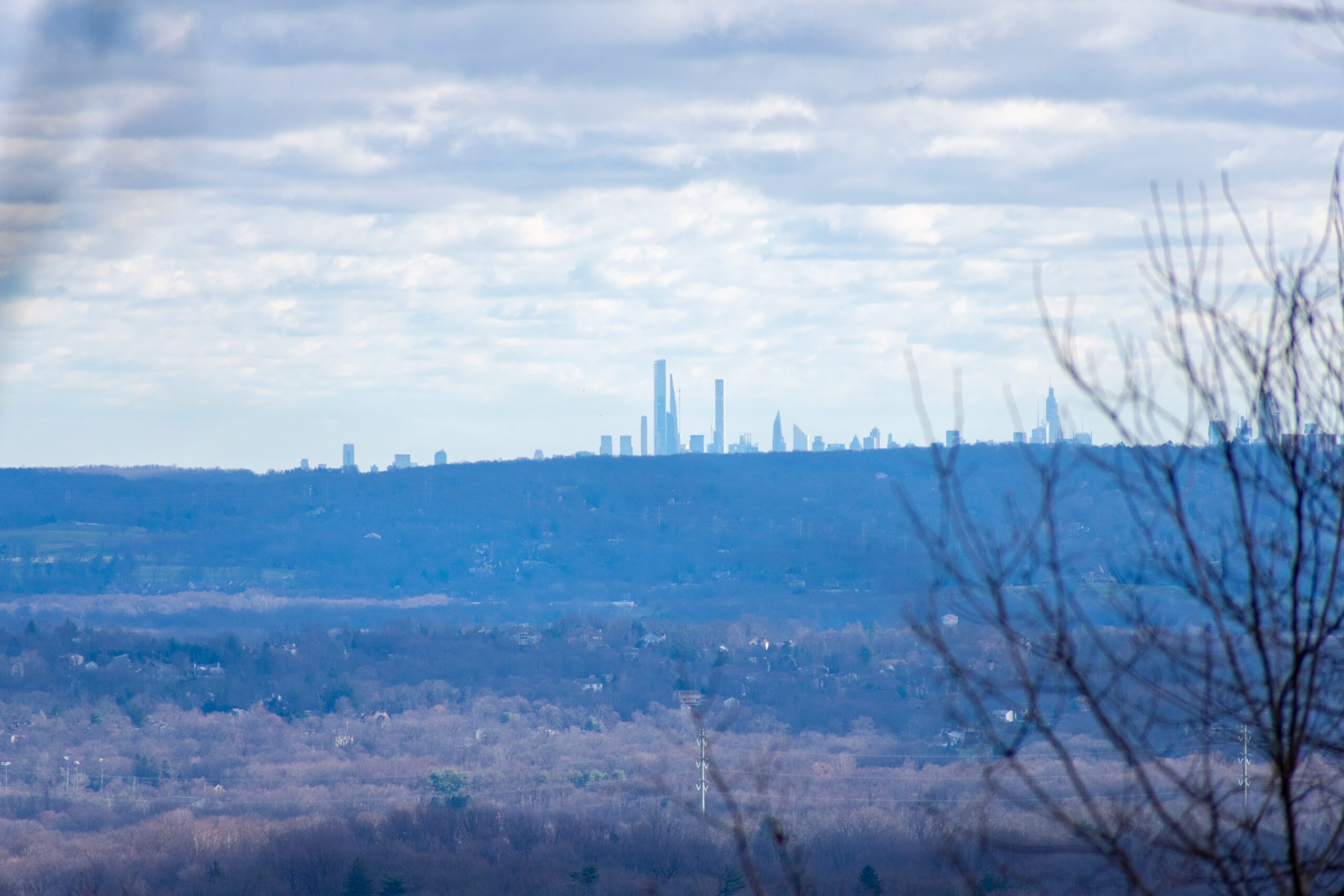
To head back to the lot, you can either retrace your steps or turn right onto the yellow trail. If you turn right, you’ll soon hit another scenic view. From this part of Tourne County Park, you can see the New York City skyline. The view is slightly obscured by trees, but makes for a great photo if you bring your telephoto lens. After this final scenic view, follow the Decamp Trail (yellow) around; first you’ll head up north before being lead south and then back out toward the lot. If you parked near Norris Road, you’ll want to follow the red trail back to the lot.
If you can’t get enough of Tourne County Park,, there are some other quick hikes you can do. One is around the Wildflower Trail Area, while the other is the Evergreen Trail; in addition, you can take a hike down south towards Boiling Spring. In fact, the park offers more than 560 acres and roughly 10 miles of trails. Meanwhile, the many activities available include hiking, fishing, horseback riding, biking, and sledding.
Click here for more of The Best NJ Hiking Trails.
All Photos: © Patrick Lombardi / Best of NJ